Every project requires the use of the right tool.
For As-built, detailed topographical surveys, or even inversed engineering, the appropriate option is to use a HDS system (High-Definition Surveying). We are highly proficient in these systems.
With this technology we can offer:
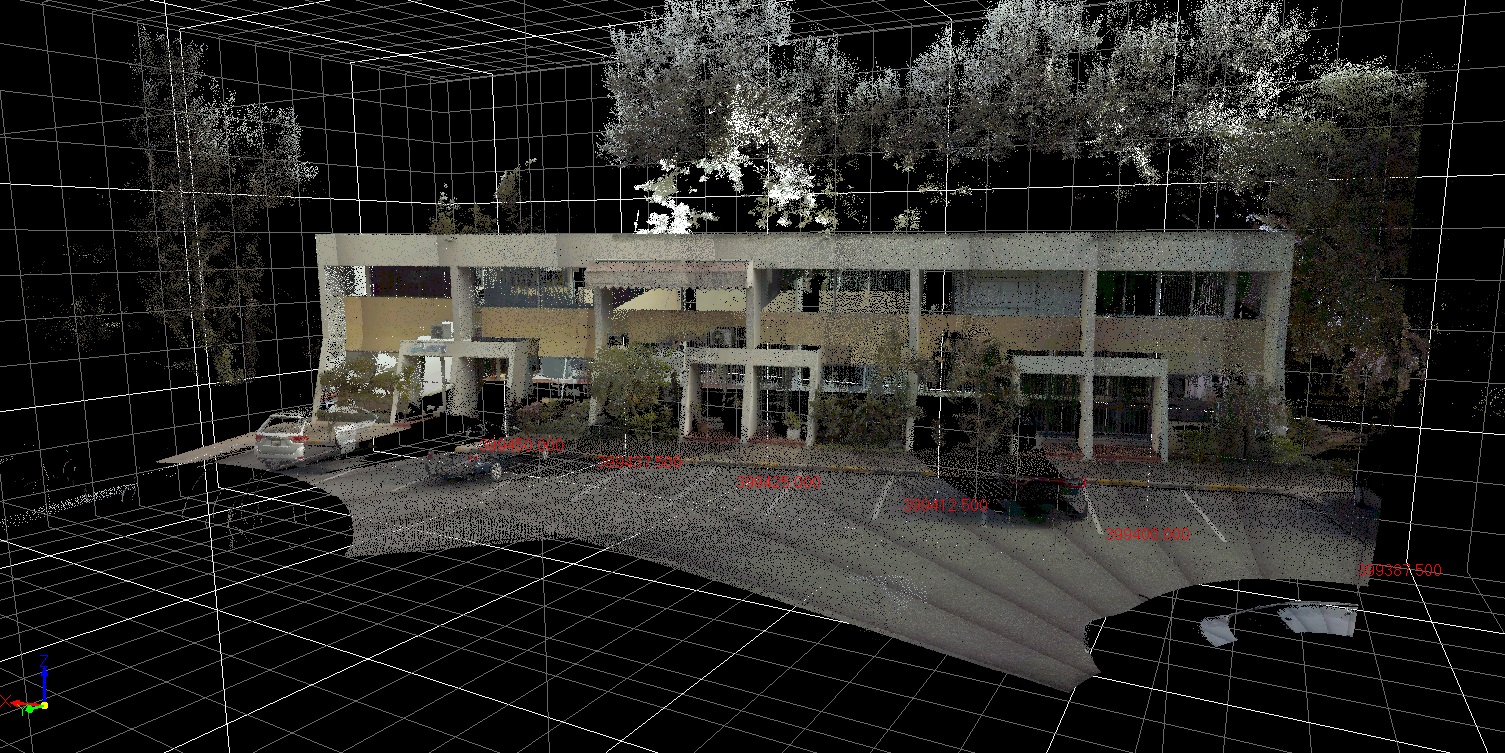
3D scanning is a fast and efficient way of performing a topographical survey of any type of surface. In regions and countries where vegetation is remarkably dense, i.e. the Caribbean, this technology offers considerable advantages compared to other procedures such as UAV. Thanks to the possibility of performing laser measurements with different optics, in most cases, it is possible to relieve forest areas down to the ground surface.
In urban areas or rich in detail, it provides a fundamental advantage compared to conventional surveying since all elements are automatically registered. This allows the filtering of information and generating high-definition topographical plans from the office from the first measure.
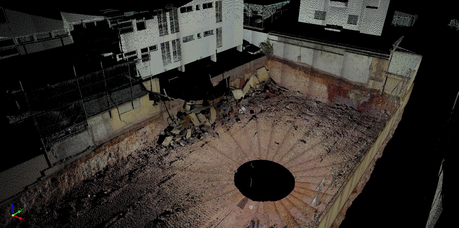
Since measurements obtained with a 3D-laser are millimetric, we can identify the movement of any structure or mass; as well as controlling slopes, and perform auscultations to determine the wear on sewage slope, pools, airport platforms, etc. All of this makes the procedure especially suitable for geotechnical studies.
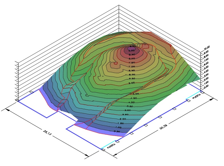
3D-laser scanning generates surfaces of millimetrical precision which allow the volumetric calculation of segments, fillings, stockpiles, open quarries, etc.
For these cases, we present to the client a point cloud, 3D models and volumetric report.
This type of high definition survey is suitable for conservation projects and general renovation. It is fundamental to apply non-invasive techniques such as 3D-laser scanning in order to protect the cultural assets of a country.
This technology allows generating products that will serve as baseline for any reconstruction or restoration work, as well as keeping a perfectly detailed inventory for the conservation of the historical assets that constitute the national heritage.
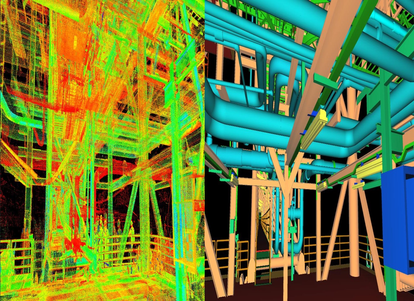
In contrast with traditional surveying and UAV systems, 3D-laser scanning systems allow surveying industrial or mining plants with maximum precision that can lead to analyze possible equipment interferences when planning a modification or expansion in the existing plant.
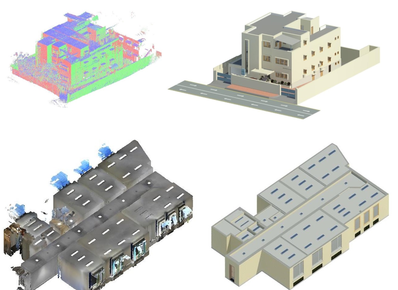
3D-laser scanning point clouds are also the baseline of the tridimensional representation of a geometric building in the BIM model (Building Information Modeling). BIM is the latest tendency in the management and coordination of general information of any architectural or industrial project. It is applied in the construction process and it can also be used for maintenance purposes.
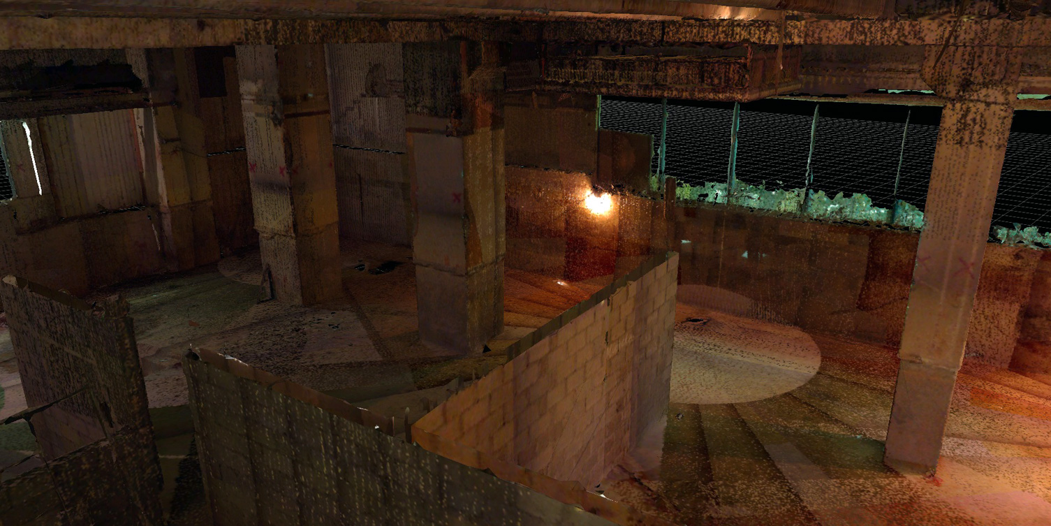
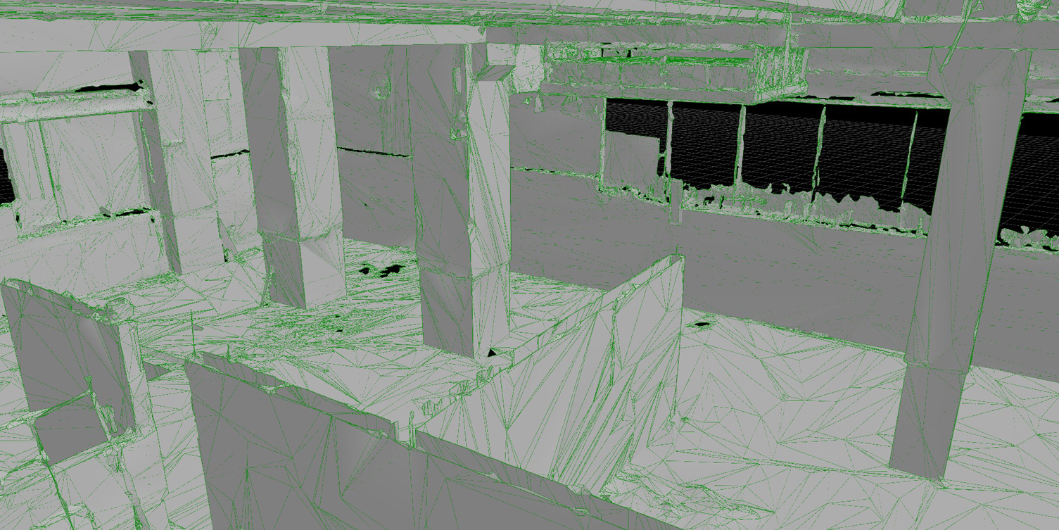
This type of topographical survey reflects a finished building with all the variations suffered during its construction. This cloud point 3D-laser survey is specially used in architecture for the inspection of facades, architectural components and structural analysis, and geometric control.
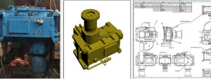
3D-laser scanning high-definition surveying is also applied in mechanical and civil engineering to model existing elements as well as process constructive blueprints.
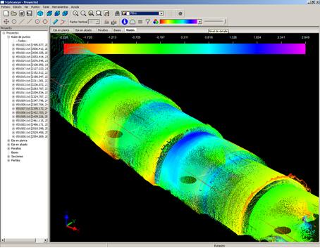
The control of tunnels and galleries is an important application of 3D high-definition scanning during the construction process.
In these cases we provide a cloud point, a 3D model and, if required, a technical report.
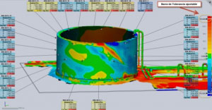
Thanks to 3D scanning we can generate deformation plans of circular elements or flat surfaces. With this procedure we can determine the degree of deformation and wear present in elements and structures with millimetrical precision.