Topographic survey requires mastering a series of techniques whether it is used for the stakeout of civil and architectural works, or topographic supervision. While some of these techniques appear to be quite simple, they need to be applied with the upmost scientific rigour. The surveyor must take into account all related concepts, simple or complex; in order to perfectly define the geometry of what needs to be projected.
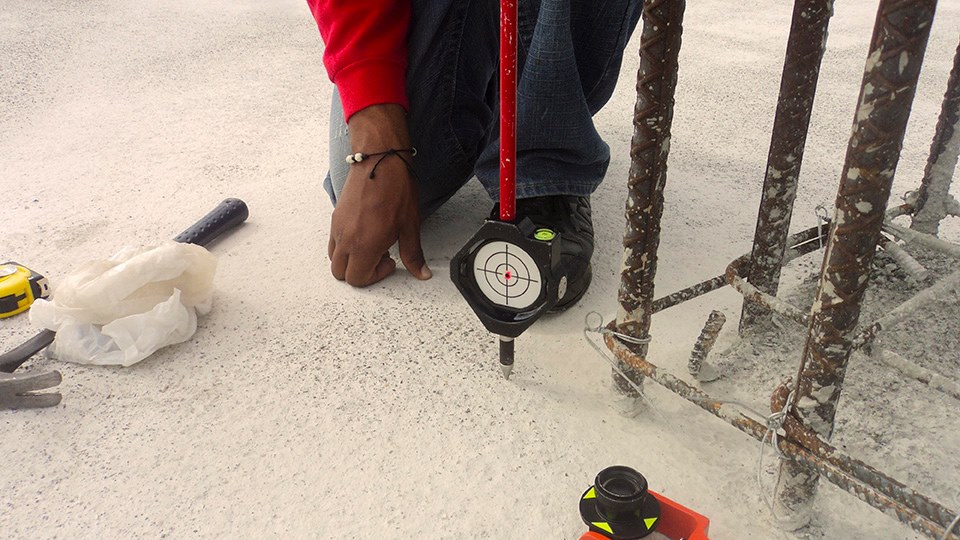
Topographic stakeout is one of the most important tasks in construction work. It implies a great responsibility and scientific judgment. An inaccurate stakeout can negatively impact a project’s budget, execution timeline and quality level.
GEOVERTICE has a vast-proven experience in the stakeout of linear projects (highways, water and gas pipelines, galleries, etc.) and non-linear projects (potable water and sewage treatment plants, buildings, dams, etc.), which has built its reputation and clients’ trust over the years.
Type of projects for which we propose our services:
Linear
Highway projects
1.1 Highways and motorways
1.2 Roads
1.3 Junctions and crossroads
1.4 Road widening and repair


Hydraulic projects
2.1 Water supply and irrigation networks
2.2 Sanitation and drainage networks
Non-linear
Residential buildings
2.1 Isolated housing
2.2 Block housing

Non-residential buildings
2.1 Shopping centers
2.2 Industrial buildings
2.3 Hospitals
2.4 Markets
Urbanizations
2.1 Residential
2.2 Industrial
Specialized projects
2.1 Bridges
2.2 Tunnels
2.3 Potable water treatment plants
2.4 Sewage treatment plants
2.5 Dams
2.6 Deposits


The movements subject to control are of small scale. They may vary, depending of the object, from a tenth of a millimeter to a few centimeters. The control of such small displacements requires the use of precise instruments and an elaborated survey methodology.
The techniques used with dedicated topographic equipment are those denominated GEODESIC METHODS:
- Triangulation
- Direct intersection
- Planimetric survey
- Angular observation
- Collimation
- Leveling
These techniques allow us to relate the movement of one part of a structure to the other, as well as the ensemble to the terrain that supports it. In addition, it allows us to verify the stability of the terrain around a structure.


By the means of the above-mentioned techniques, we can perform partial or total inspections of the elements staked out by the constructing firm responsible for the civil or architectural works.
We normally participate, with other firms and freelancers, in the reporting of the progression of the works under supervision.


